Founded in the folding of the era (circa 16 BC), Bracara Augusta is one of the three urban centers of the peninsular northwest region, created in the context of an administrative organization, carried out by Emperor Cesar Augustus.
The importance that it came to know over more than five centuries, rests directly on the existence here, from the outset, of six great roads (XIV, XVI, XVII, XVIII, XIX and XX of the Antonine Itinerary), and that from here they went to all directions of the Iberian Peninsula.
As capital of conventus iuridicus, it holds important judicial, fiscal, administrative and religious functions. Under the domain of the Flavian dynasty, Bracara Augusta goes under a great economic flourishing and urban development, that later justifies its elevation to the capital of the province of Galecia, created by Diocletian.
In the course of the IV century, Bracara Augusta is still a flourishing city, and becomes the episcopal see. Later, after the fall of the Roman Empire in the West and the barbarian invasions, it becomes the capital of the Suevian Kingdom, with the installation of these people in the region. However, still in the middle of the VI century, the city subsists as a religious and cultural center. Apparently, more than the barbarian invasions, the successive attacks and destructions by the Arabs were the responsibles for the decay and widespread abandonment of Bracara Augusta.
During the Middle Ages, the Roman city of Bracara Augusta, is partially sacrificed by the medieval city and buried largely in its farms and backyards.
From the seventies of last century, with the constitution of the first team of peninsular archeology, with systematic intervention in urban areas, Bracara Augusta begins to be gradually rediscovered, being today, thanks to it, the urban center with the best known nationally map of the archaeological subsoil.
From the intensive and rigorous work developed over more than four decades by this pioneering team, based at the University of Minho Archaeological Unit, resulted an immense and rich archaeological treasure, visible through permanent exhibitions in the modern and functional D. Diogo de Sousa Regional Museum of Archeology, and in a set of ruins contained in urban archaeological spaces duly musealized and open to the public.
BRACARA AUGUSTA – Braga, Portugal
- Archaeological Ruins of the Frigideiras do Cantinho (Ruínas Arqueológicas das Frigideiras do Cantinho)
- Fountain of the Idol
- Pius XII Museum
- Archaeological Ruins of Paularte Office (Ruínas Arqueológicas da Oficina Paularte)
- Domus of the Cathedral’s Old School
- Roman Ruins of Carvalheiras (Insula das Carvalheiras)
- Station balnéaire Préromaine de la Station
- Roman Baths of Alto da Cividade
Archaeological Ruins of the Frigideiras do Cantinho (Ruínas Arqueológicas das Frigideiras do Cantinho)
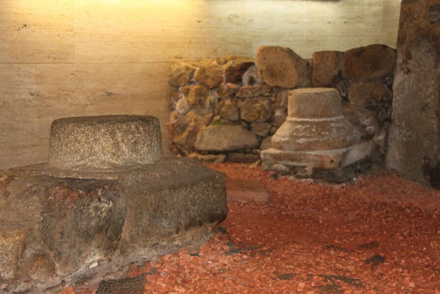
Nucleus of ruins of a Roman Domus, musealized under the floor of one of the oldest bakeries in Braga. Here, there are remains of compartments, and of a hypocaust of a seaside resort, belonging to the housing structure, dating from the III / IV AD centuries.
Largo São João Souto 1
4700-326 Braga
GPS Coordenates:
Latitude 41.5501245
Longitude -8.4274053
https://www.frigideirasdocantinho.pt
Phone: +351 253 263 991
frigideiras.cantinho@gmail.com
Timetable
- Tuesday to Thursday: 8 a.m. to 8 p.m.
- Friday to Sunday: 8 a.m. to 10 p.m.
- Closed: Monday
Fountain of the Idol
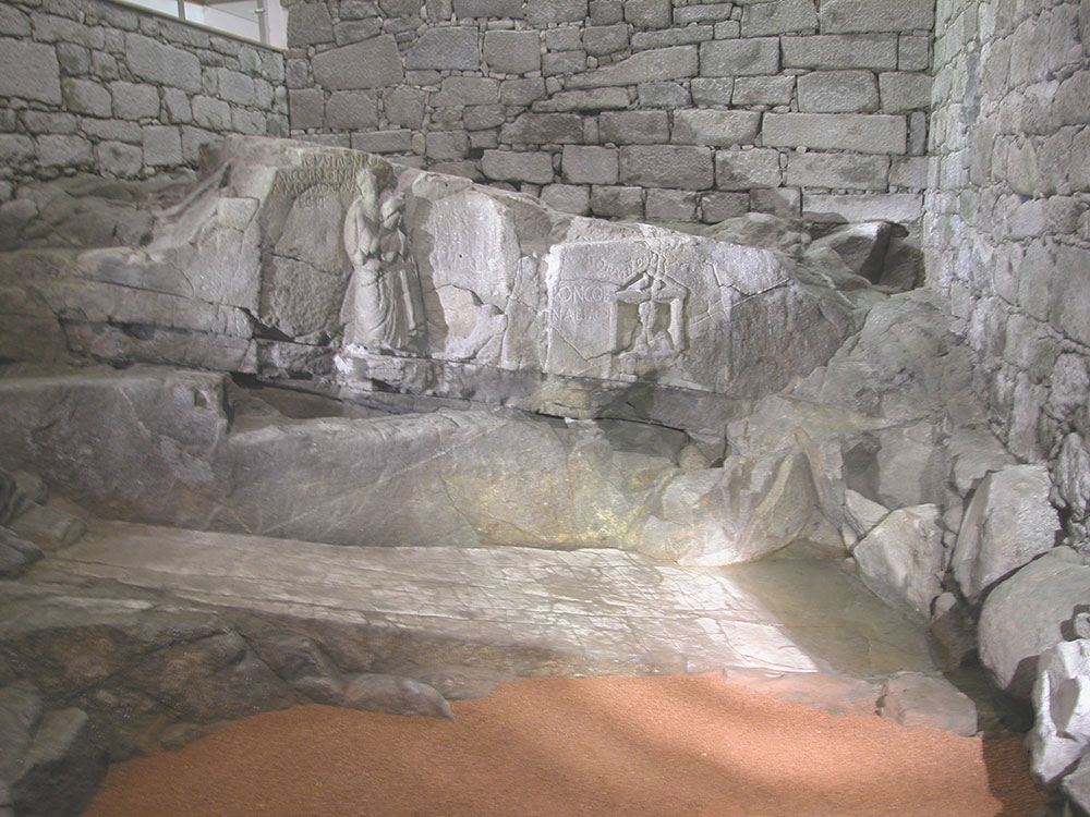
It is a rock sanctuary of pre-Roman origin, dedicated to the indigenous goddess Nabia, closely linked to the cult of water and fertility. It was monumentalized at the beginning of the city’s foundation by an immigrant named Celico Fronto, who ordered the sculptures and inscriptions visible in front of the sanctuary.
Later, the descendants of this immigrant renewed the monument building a lake in front of the fountain facade.
Rua do Raio, 379
4700-924 Braga
GPS Coordenates:
Latitude 41.5487065
Longitude -8.4239546
https://www.cm-braga.pt
Phone: +351 253 218 011
fonte.idolo@cm-braga.pt
Timetable
- Monday to Friday: 9: 30-13: 00h. and 14: 00-17: 30h.
- Saturday: 11: 00-17: 30h.
- Sunday closed
Pius XII Museum
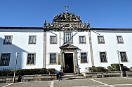
The Pius XII Museum provides visitors with a tour of history, from the period of the Paelolithic to the Iron Age, from the romanization to the Christian era. Each epoch is documented with abundant traces. Among the exhibits are a bronze gladiator, a grandiose dolium and a Roman mosaic, the result of excavations in the cloister of the Conciliar Seminary of St. Peter and St. Paul. These excavations uncovered a Roman Domus.
Largo de Santiago, 47
4704-532 Braga
GPS Coordenates:
Latitude 41.5480965
Longitude -8.428075
www.museupioxii.com
Phone: +351 253 200 130
geral@museupioxii.com
Archaeological Ruins of Paularte Office (Ruínas Arqueológicas da Oficina Paularte)
Traces of sidewalk and turret associated with a Roman wall, dating from the middle of the century III AD. There are vestiges of the door corresponding to the maximum thistle of Bracara Augusta, where was located the old Roman route XIX (Antonine itinerary) in direction of Lucus Augusti.
Domus of the Cathedral’s Old School

Arising from an archaeological intervention directed by the Archaeological Office of the Braga City Hall, these ruins depict important moments of evolution of the urban fabric of Braga, as exemplified by the remains of a housing structure from the I / IV century AD, as well as vestiges of the ancient medieval fence and a tower from the XIV century AD.
Rua D. Afonso Henriques, 1
4700-424 Braga
GPS Coordenates:
Latitude 41.5488015
Longitude -8.4304673
www.cm-braga.pt
Phone: + 351 253 203 150
arqueologia@cm-braga.pt
Timetable
- From Tuesday to Friday: from 9:30 a.m. to 11:30 a.m. and from 2:30 p.m. to 4:30 p.m.
Roman Ruins of Carvalheiras (Insula das Carvalheiras)
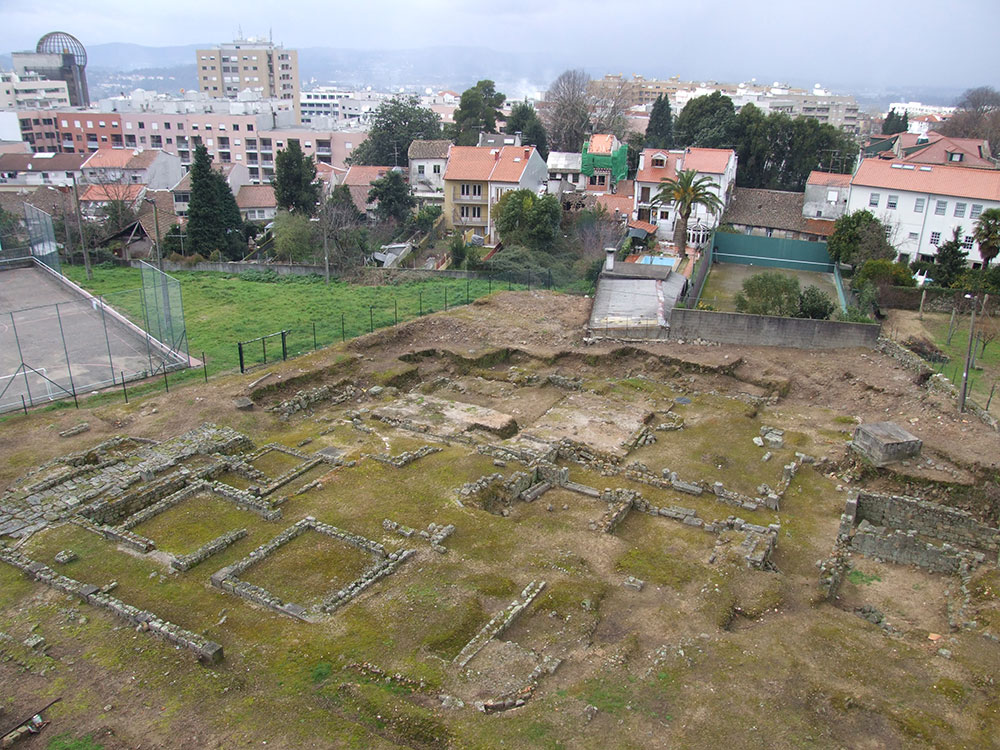
The excavations carried out allowed the discovery of remains of a residential area delimited by streets, lined with porticoes (I / VI AD), thus defining an urban block (insulae) of the old Bracara Augusta.
Classified as a Property of Public Interest since 1990, the archaeological ruins of Carvalheiras are currently under musealization
Sé, Braga
GPS Coordenates GPS:
Latitude 41.5483328
Longitude -8.4314146
www.cm-braga.pt
Phone: (+ 351) 253 262 550
turismo@cm-braga.pt
Station balnéaire Préromaine de la Station
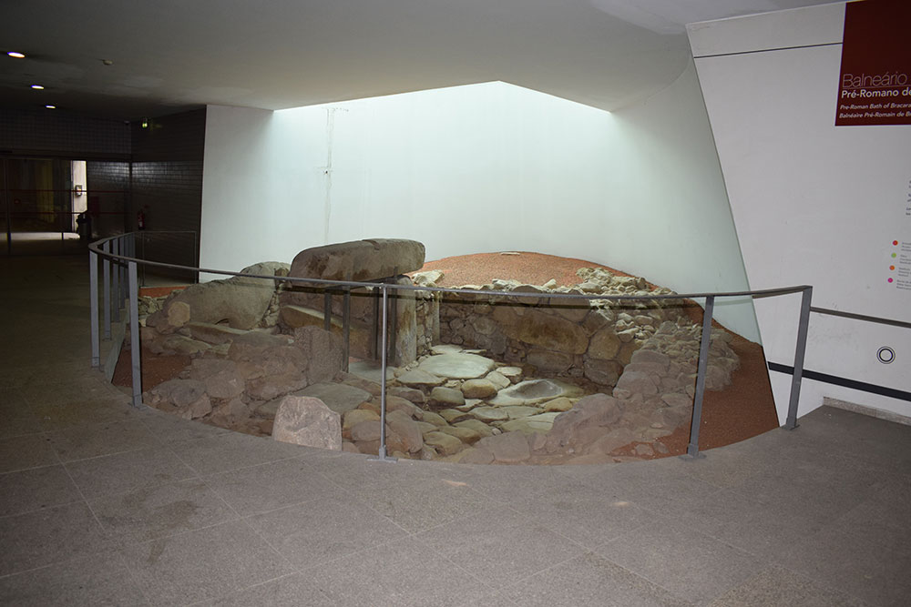
Monument d’une tradition indigène, identifié dans le cadre d’un accompagnement archéologique effectué par l’Unité d’Archéologie de l’Université du Minho en 2000, lorsque la gare ferroviaire actuelle de Braga a été réaménagée. Ces ruines correspondent à une station balnéaire avec des fonctions rituelles et sont actuellement intégrées dans le sous-sol du bâtiment de la Station, dont les murs comprennent un ensemble de panneaux d’information.
Largo da Estação
4700-223 Braga
GPS Coordenates:
Latitude 41.548797
Longitude -8.434082
Roman Baths of Alto da Cividade
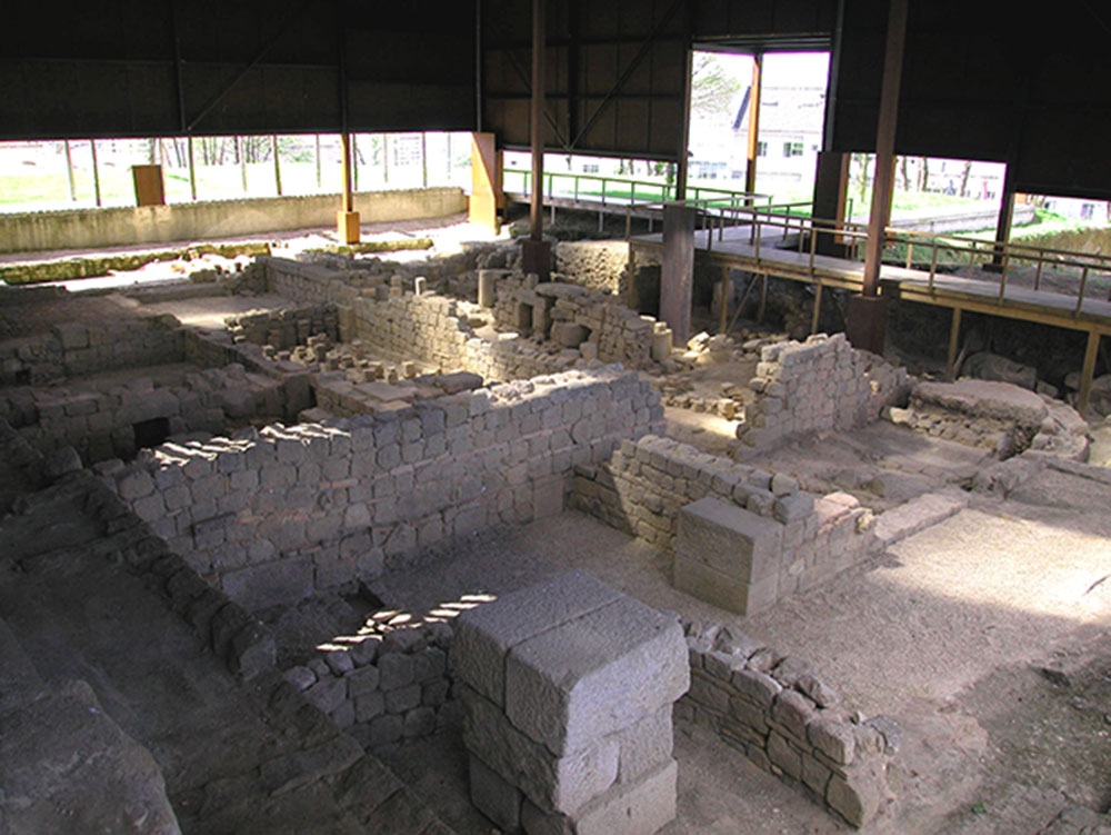
On the hill of Alto da Cividade, inside a large protected and fenced area, there are some of the Roman public baths known up to now in Braga. The building was discovered in 1977, when the first excavations on site were carried. At the moment, the Roman baths of Alto da Cividade are classified as a National Monument, are musealized and open to the public.
Rua Dr. Rocha Peixoto
4700-043 Braga
GPS Coordenates:
Latitude 41.5462545
Longitude -8.4318323
www.cm-braga.pt
Phone: + 351 253 278 455
termas.romanas@cm-braga.pt
Timetable
- Tuesday to Friday from 9:00 a.m. to 1:00 p.m. and from 2:00 p.m. to 6:00 p.m.
- Saturdays, Sundays and holidays from 10:00 a.m. to 5:00 p.m.
D. Diogo de Sousa Museum of Archeology
Inaugurated in June 2007, this museum, under the tutelage of the Regional Directorate for the North Culture (DRCN), has collections resulting from the archaeological investigation carried out throughout the times in the northern region, with greater incidence in the county of Braga. Its collection covers a vast chronological and cultural period, between the Palaeolithic and the Middle Ages.
R. dos Bombeiros Voluntários s/n
4700-025 Braga
GPS Coordenates:
Latitude 41.5462595
Longitude -8.427241
www.museuddiogodesousa.gov.pt
Phone: +351 253 622 670
mdds.diretora@culturanorte.gov.pt
Timetable
ACCOMMODATION
Restaurants
Tourism Office
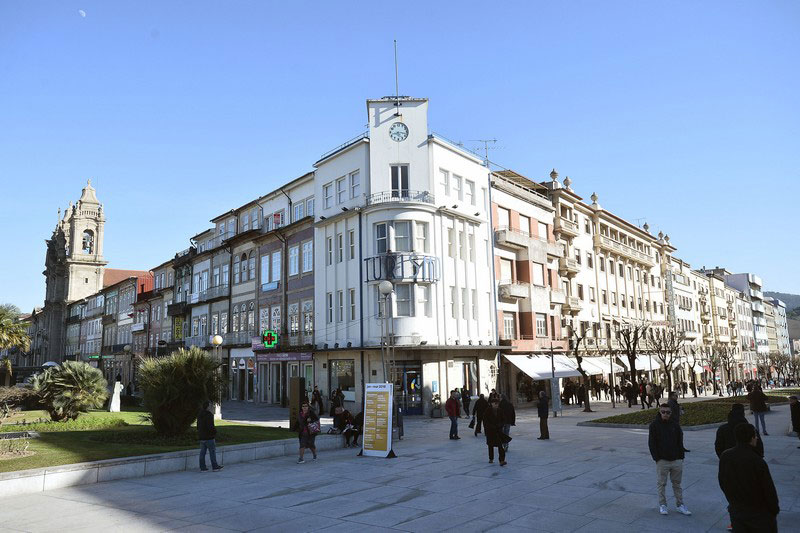
Avenida da Liberdade, 1
4710 – 305 Braga
GPS Coordenates:
Latitude 41.5509948
Longitude -8.424827
Timetable
- Monday to Friday: 9:00 a.m. to 1:00 p.m. and from 2:00 p.m. to 6:30 p.m.
- Saturday and Sunday: 9:00 a.m. to 1:00 p.m. and from 2:00 p.m. to 6:00 p.m.
HOW TO GET
Thanks to its great location, Braga is easily accessible by car, train, taxi or bus.
The city is served by 5 highways: by the North (A3), South (A3 and A1 from Lisbon), East (A11 and A7) and West (A28).
The train connects Braga to several points in the country, through the CP services (Alfa Pendular, Intercity, Urban Trains of Porto).
In terms of road transportation, Braga’s Bus Station hosts the companies Arriva, Citi express, EBA, Get Bus, Internorte, Rede Expressos, Renex, Rodonorte, Salvador Alves e Fihos lda, Transdev, assuring the connection to several regional, national and international destinations.
The “Francisco Sá Carneiro” Airport is the main axis in the Northwest region of the Iberian Peninsula which receives the most relevant airline companies and low cost flights (30 minutes by highway, nearly50 kilometres away from Braga). The airport is easily accessible by the A3 highway, by the Metropolitan of Oporto and the CP trains, or even through the shuttle service provided by Get Bus.
The airport of Vigo is 100 kilometres away, and there are bus routes that directly connect these two cities on a daily basis.
The Port of Leixões is the biggest port infrastructure of Northern Portugal and one of the most important ones in the country (45 minutes away from Braga by highway).
As for public transportation, the municipality is served by Braga’s Urban Transportation (Transportes Urbanos de Braga – TUB).
